visionairy®
Map Based Relocalization - IR | EO
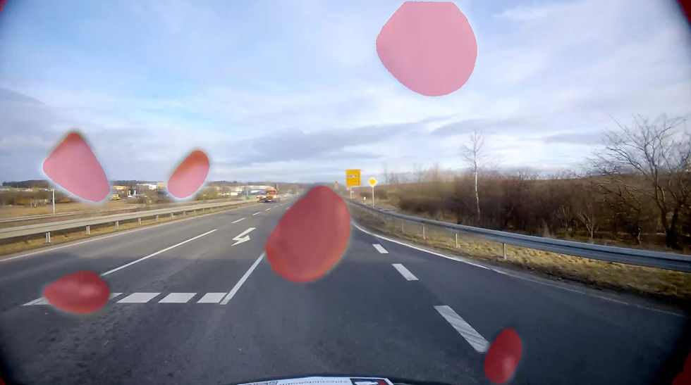
Modern UAVs and ground robots often operate in environments where GNSS is unavailable, unreliable, or disrupted such as indoors, urban canyons, deep valleys, or under jamming conditions. Map-Based Relocalization - IR | EO enables precise position estimation by matching camera imagery to satellite imagery.
Why Map Based Relocalization - IR | EO?
Modern UAVs and ground robots often operate in environments where GNSS is unavailable, unreliable, or disrupted such as indoors, urban canyons, deep valleys, or under jamming conditions.
Map-Based Relocalization - IR | EO enables precise position estimation by matching camera imagery to satellite imagery.
GPS-Independent Localization
Efficient Performance
Robust Motion Estimation
See how it works

No satellite data? No problem — use Gaussian splats

Benefits
GNSS-Independent Localization
Provides a robust fallback solution using only passive sensors, ensuring reliability even in GNSS-challenged environments.
Robust and Adaptable
Operates seamlessly on low-power hardware, making it ideal for resource-constrained platforms.
Enhanced Accuracy with Visual Odometry
Can be seamlessly combined with visual odometry to further improve positional accuracy and update rate.
Features
VISIONAIRY® integrates data from multiple sensor modalities to ensure reliable operation under all environmental conditions.
Our advanced sensor fusion algorithms significantly reduce drift compared to standalone visual or inertial estimation. This ensures precise and reliable trajectory estimation, even during extended operations in GPS-denied environments.
Visual Cameras - High-resolution RGB imaging for feature detection and tracking
Pre-built Map - A high-resolution spatial reference generated from prior sensor data (e.g., visual, LiDAR, or depth).
Thermal Imaging - Infrared sensing for night operations and through-obstacle detection
Localization Algorithm - Matches live sensor input against the pre-built map to recover accurate position.
Pose Estimation Engine - Calculates the 6DoF (position and orientation) of the device relative to the map.
Inertial Measurement - Precision motion tracking independent of external references
Map Management System - Stores, retrieves, and updates maps locally or via the cloud for scalable operation.
These performance metrics are for demonstrative purposes only, based on configurations with proven results. Actual performance may vary by setup. Our algorithms are optimized for use with any chip, platform, or sensor. Contact us for details.
Position accuracy
±15 m in typical environments
update rate
Up to 20 Hz depending on the hardware
initialization time
<1 second
Maximum Velocity
120m
Operating Range
Unlimited (environment-dependent)
Supported companion hardware
Nvidia Jetson, ModalAI Voxl2 / Mini, Qualcomm RB5, IMX7, IMX8, Raspberry PI
Supported flight controllers
PX4, APX4, Ardupilot
Basis-SW/OS
Linux, Docker required
Interfaces
ROS2 or Mavlink
Input - Sensors
1) Any type of camera (sensor agnostic)
2) Any type of global orientation (optional)
Input - Data
1) Camera's video frames
2) Global orientation
3) Intrinsic camera calibration
Output - Data
Global position estimate
Minimum
Recommended
RAM
2 GB
4 GB
Storage
20 GB
50 GB
Camera
640 x 480 px, 10 FPS
1920 x 1080 px, 30 FPS
IMU
100 Hz
300 Hz
The information provided reflects recommended hardware specifications based on insights gained from successful customer projects and integrations. These recommendations are not limitations, and actual requirements may vary depending on the specific configuration.
Our algorithms are compatible with any chip, platform, sensor, and individual configuration. Please contact us for further information.
Performance Metrics
Position accuracy
±2.5 cm in typical environments
update rate
Up to 200 Hz
initialization time
<1 second
Maximum Velocity
20 m/s with full accuracy
Operating Range
Unlimited (environment-dependent)
Drift
<0.1% of distance traveled


