What they do
Aerialoop is redefining the future of logistics as a middle-mile drone delivery airline, pioneering point-to-point aerial bridges—or “loops”—that transform how goods move across Latin America. With advanced logistics technology and airline grade safety standards, Aerialoop operates centrally controlled, high-frequency deliveries across multiple international routes. Their services range from commercial routes for diverse clients to private and remote routes that bring essential supplies to low-access areas, ensuring impactful solutions for communities and businesses alike.
Headquartered in Miami, Florida, and rapidly expanding in South America, Aerialoop has scaled to over 300 weekly flights and mapped out logistics networks spanning more than 1,000 routes. Their fleet’s relentless pace—launching a new flight every seven minutes—provides fast, cost-effective deliveries while slashing carbon emissions by up to 90%.
Guided by visionary leaders like Daniel Leng and Gabriela Sommerfeld, Aerialoop invites partners to “Don’t just look forward, look from above,” unlocking a future where aerial logistics empower e-commerce and sustainable growth throughout the region.

“From the start, Spleenlab has demonstrated exceptional expertise in vision and LiDAR-based autonomy for UAVs. Their deep understanding of the interface with flight control systems made integration seamless. From day one, our technical teams were perfectly aligned, enabling the smooth integration of Spleenlab's system into Aerialoop’s UAVs. Their ongoing support and proactive development of new features have become a key part of our strategy to make BVLOS operations as safe and reliable as possible.”
Andreas Antener | CTO & Co-Founder, Aerialoop

1
Scaling the Sky: Network Complexity
Managing thousands of aerial routes demands sophisticated airspace coordination, regulatory compliance, and real-time optimization to maintain safety and efficiency at scale.
2
Payload vs. Profit: Balancing Economics
Delivering cost-effective mid-mile drone services means constantly optimizing payload capacity, battery endurance, and operational costs to ensure profitability while keeping prices competitive.
3
Data is the New Airspace: Integrating Smart Systems
Seamless integration of AI-driven flight control, logistics software, and regulatory data is crucial to enable autonomous operations and unlock future expansion into new markets.
Challenges

our AI solution
Precision AI for Precision Delivery: How VISIONAIRY® Powers Aerialoop’s Autonomous Drone Network
Aerialoop leverages VISIONAIRY® Precision Landing software to transform the complexity of drone delivery into a highly reliable, scalable operation. This advanced AI solution enables drones to execute pinpoint landings in diverse environments, from bustling urban rooftops to remote rural outposts, significantly reducing the margin for error and operational risk. By ensuring precise touchdown even in GPS-challenged or cluttered areas, VISIONAIRY® directly addresses the challenge of managing a vast and complex aerial network, keeping flights safe, compliant, and efficient across thousands of routes.
Beyond landing accuracy, VISIONAIRY® empowers Aerialoop to expand autonomous operations, lowering the reliance on human oversight and driving cost efficiency. The software integrates seamlessly with onboard sensors and flight control systems, feeding real-time data into Aerialoop’s centralized logistics platform. This integration enables smarter flight planning, optimized energy use for longer ranges, and safer operations, ultimately supporting Aerialoop’s mission to deliver faster, greener, and more economically sustainable drone logistics across Latin America and beyond.

VISIONAIRY® GPS-Denied Navigation
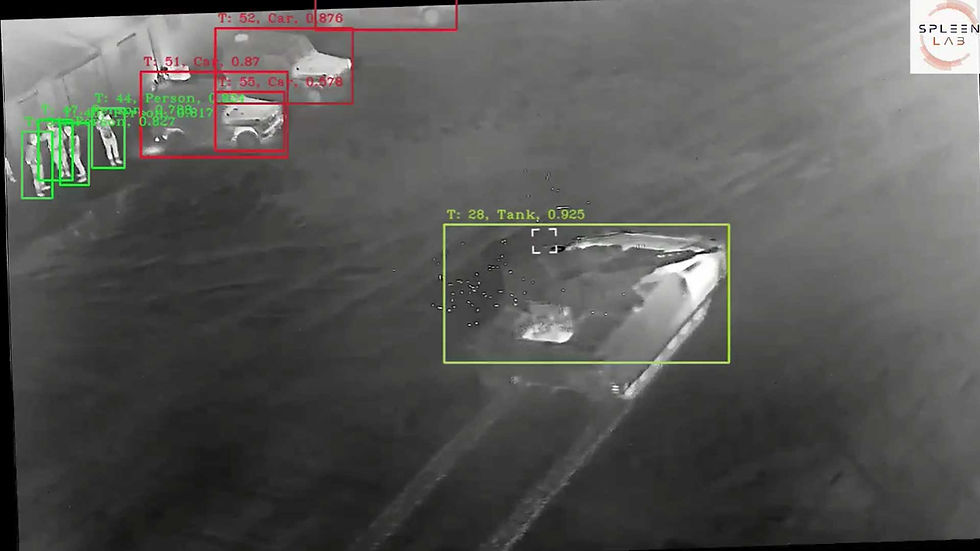
Enables Quantum-Systems drones to detect and track multiple targets simultaneously with high accuracy, even in complex and GPS-denied environments. Optimized for onboard AI processing, it enhances situational awareness and supports autonomous mission execution by providing real-time, reliable target monitoring.

VISIONAIRY® Single Object Tracking
Our Single Object Tracking solution equips Quantum-Systems drones to reliably follow a selected target with high precision throughout the mission. Real-time onboard processing ensures stable tracking and continuous updates, even in dynamic or GPS-denied environments, supporting focused, responsive operations.

VISIONAIRY® GPS-Denied Navigation
Our GPS-Denied Navigation solution leverages Visual-Inertial Odometry (VIO) combined with Map-Based Relocalization to enable Quantum-Systems drones to accurately localize and navigate autonomously when GPS is unavailable or jammed. By fusing visual and inertial sensor data with pre-built maps, the drones maintain reliable positioning and mission continuity even in highly contested environments.


Impact
Precision Landings, Anywhere
VISIONAIRY® ensures drones achieve pinpoint landings even in complex urban or remote environments, boosting safety and reliability across Aerialoop’s routes.
Autonomy at Scale
Spleenlab’s AI reduces the need for manual oversight, enabling Aerialoop to expand its autonomous operations and manage thousands of flights seamlessly.
Operational Efficiency
By optimizing landing accuracy and flight paths, Spleenlab’s technology helps Aerialoop lower costs, conserve battery life, and maximize payload capacity.
Regulatory Confidence
VISIONAIRY® enhances situational awareness and compliance, supporting Aerialoop’s efforts to meet stringent aviation regulations in diverse international markets.